
Loon Lake Mountain
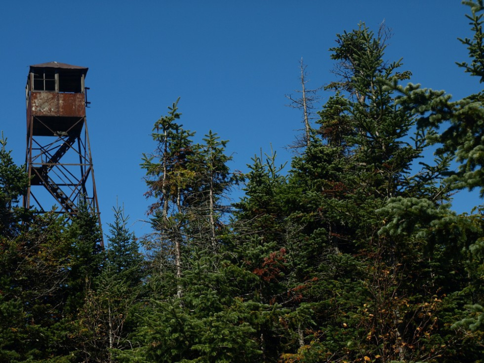
This is a moderately difficult route that follows old woods roads and a steep trail to the summit, where there are great views from the ground and a 35-foot fire tower. Unfortunately, at this time, the tower cannot be climbed.
How to get there
From Saranac Lake take Route 3 east and turn left on County Route 26 after about 15.5 miles. The parking area is on the left after about 8 miles.
By the numbers
- Distance: 2.7 miles to the summit
- Elevation: 3,314 feet
- Ascent: 1,600 feet
Hiking
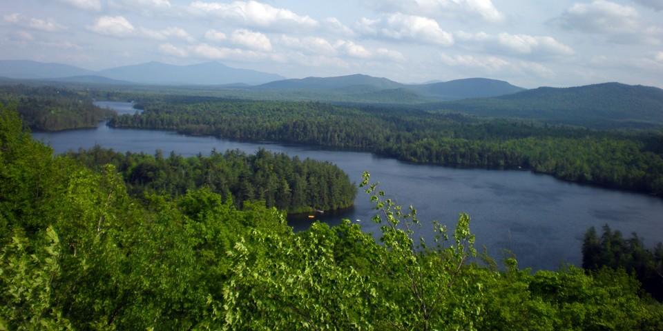
The trail starts out following an old woods for a little over 1.25 miles to where there's an arrow pointing left, to the foot path. From the turn, the trail begins to climb toward the summit. At 2 miles there is the first of several bridges — things also get progressively steeper from this point on. The final push to the top ascends a mossy, rocky stream that's steep and slippery. The views from the summit rock are outstanding, and hikers can explore around the summit for additional views of the area. This is a calf burner, but the views are worth it!
Loon Lake Mountain in winter
Loon Lake Mountain is a difficult snowshoe, so be sure to leave early. Snowshoes are necessary to avoid postholing through the snowpack, and snow spikes are suggested for ascending the mountain's steeper sections, although they might not be absolutely necessary. Extra layers of non-cotton clothing, a windbreaker, emergency blanket, first-aid kit, headlamp with extra batteries, and plenty of food and water are essential items for any winter excursion. The extra layers and windbreaker are especially important on the summit, which is exposed and likely to be much colder than the lower sections of the mountain.
Loon Lake Mountain
- Route 26Loon Lake, NY 12989

Packages and Promotions
range
Valid Apr. 6
- Apr. 9
Valid Mar. 12
- Apr. 9
Total Solar Eclipse at Hohmeyer's Lake Clear Lodge & Resort
Lake Clear Lodge & Retreat
Lake Clear Lodge & Retreat, Lake Clear Lodge | Adirondack Alps Restaurant
This total package for the total eclipse leaves nothing out - 2 or 3 night lodging options with all meals included and on site.
package
Eclipse ADK 2024, Special Events, Dining Deals