
South Creek to Hungry Bay via Middle Saranac Lake
The destination on this trip is a high rock face on the eastern shore of Hungry Bay, south of campsite 82. This paddling route begins on a small creek, where you are surrounded by bog plants including tamarack trees, pitcher plants, Labrador tea, sundew, sheep laurel, steeplebush, yellow pond lily, white water lilies, pickerelweed, bladderworts, blue flag iris, and bog rosemary. Otters, beavers, fishers, and mink are sometimes visible in the creek area on a quiet day. Red-winged blackbirds, osprey, Canada geese, common loons, and black ducks are frequently seen here as well.
Fact check
- Total distance: Approximately 4.4 miles round trip
- Length of time: 3+ hours
- No portages
- Flatwater
- Round trip
- Motorboats can access Middle Saranac Lake via State Bridge Boat Launch
Logistics
- Public parking is available at State Bridge Boat Launch at Second Pond
- Put in/take out at State Bridge Boat Landing at Second Pond
The paddle
Put in at South Creek access and paddle toward the right, under the bridge. The creek opens up into Middle Saranac Lake. Paddle north past Ship Island into Hungry Bay. As you paddle out into Middle Saranac Lake take in the view of Whiteface Mountain and the McKenzie Mountain range to the right. There are several islands with state campsites along the way — these sites must be reserved in advance if you wish to camp.
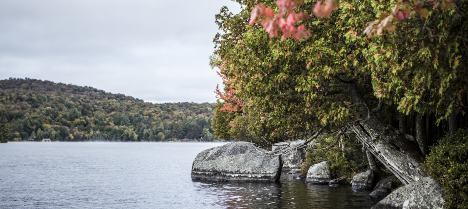
When you reach Hungry Bay, you will see a bog area on the left shore and a large rock face that makes a great place to picnic and watch the view. Across the bay, campsite 81 has a lean-to that was built in memory of Martha Reben, author of The Healing Woods, The Way of the Wilderness, and A Sharing of Joy—which are delightful stories of her years spent camping on Middle Saranac Lake and nearby Weller Pond.
Recommended resource
Adirondack Paddler’s Map: The Saranac Lakes
South Creek to Hungry Bay via Middle Saranac Lake
- Route 3Saranac Lake, NY 12983
info@saranaclake.com

Packages and Promotions
range
Valid Apr. 6
- Apr. 9
Valid Mar. 12
- Apr. 9
Total Solar Eclipse at Hohmeyer's Lake Clear Lodge & Resort
Lake Clear Lodge & Retreat
Lake Clear Lodge & Retreat, Lake Clear Lodge | Adirondack Alps Restaurant
This total package for the total eclipse leaves nothing out - 2 or 3 night lodging options with all meals included and on site.
package
Eclipse ADK 2024, Special Events, Dining Deals