- Out and Back
- Out and Back
- Out and Back


About
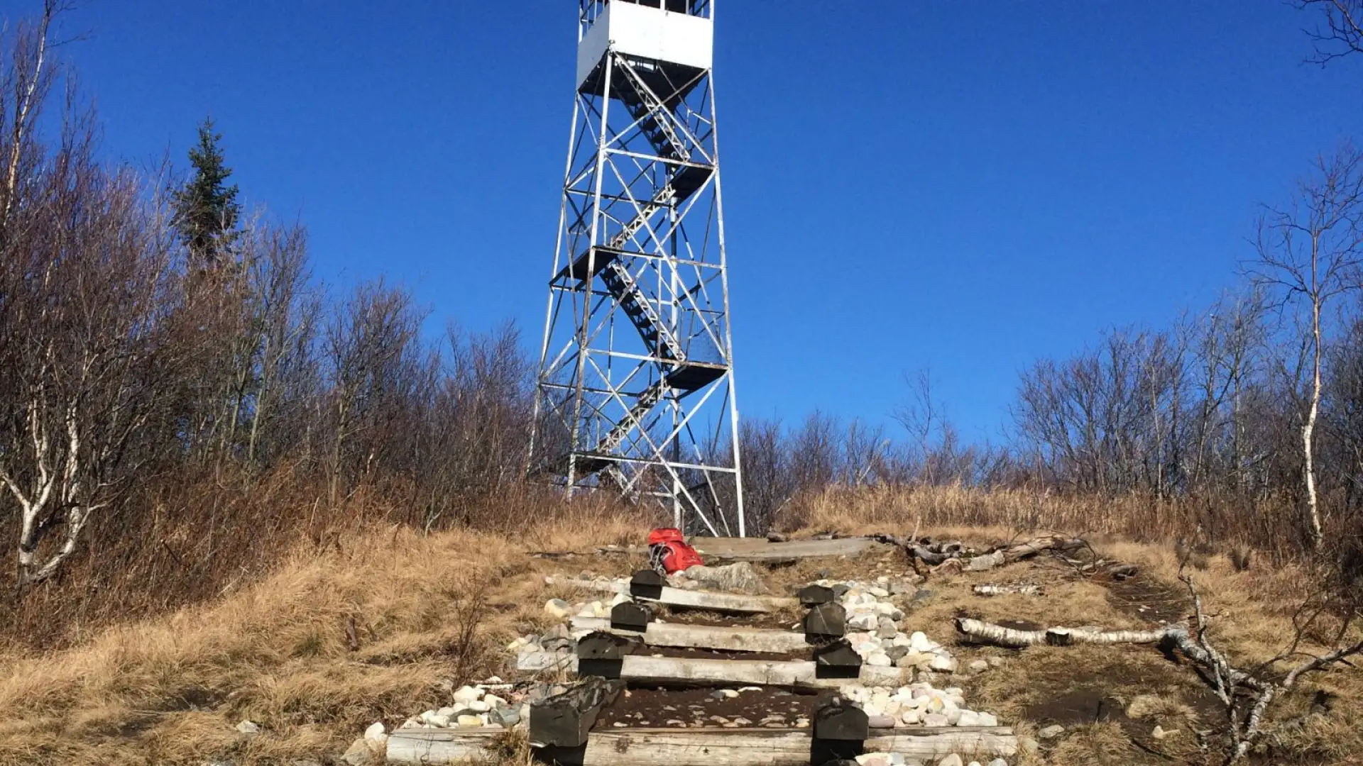
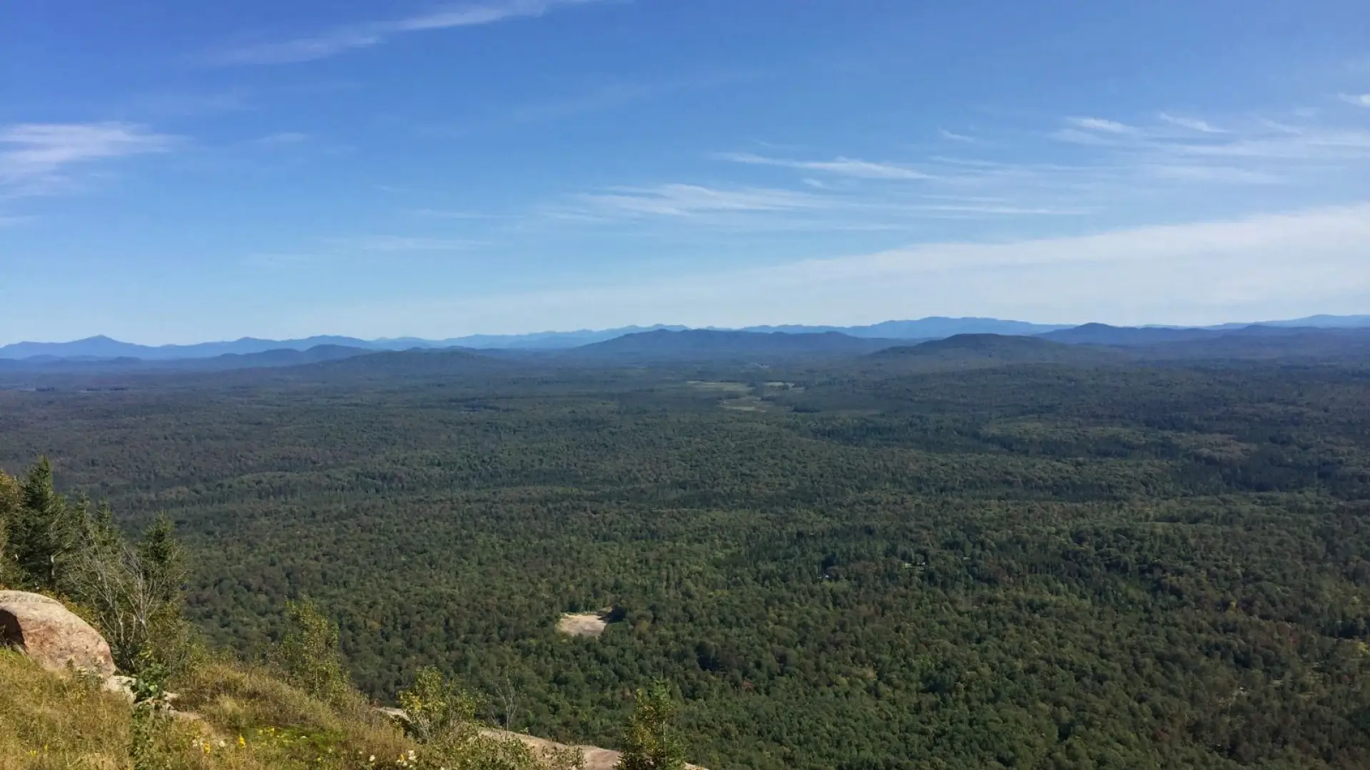
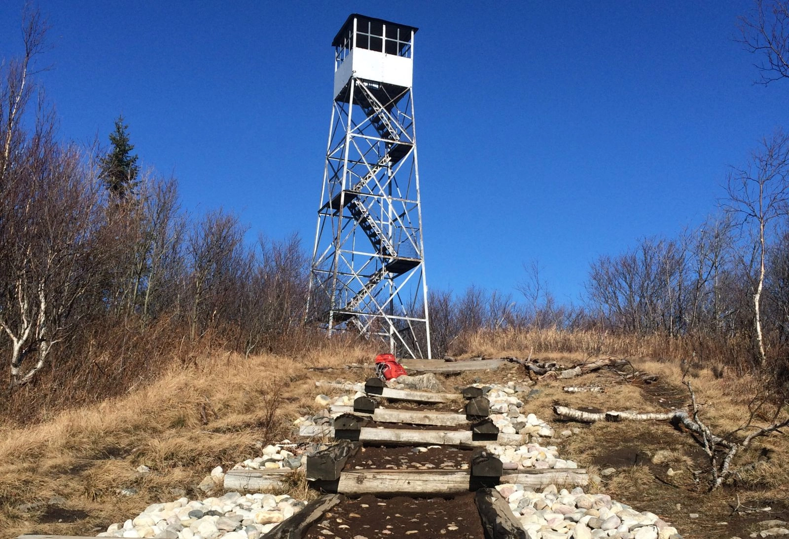
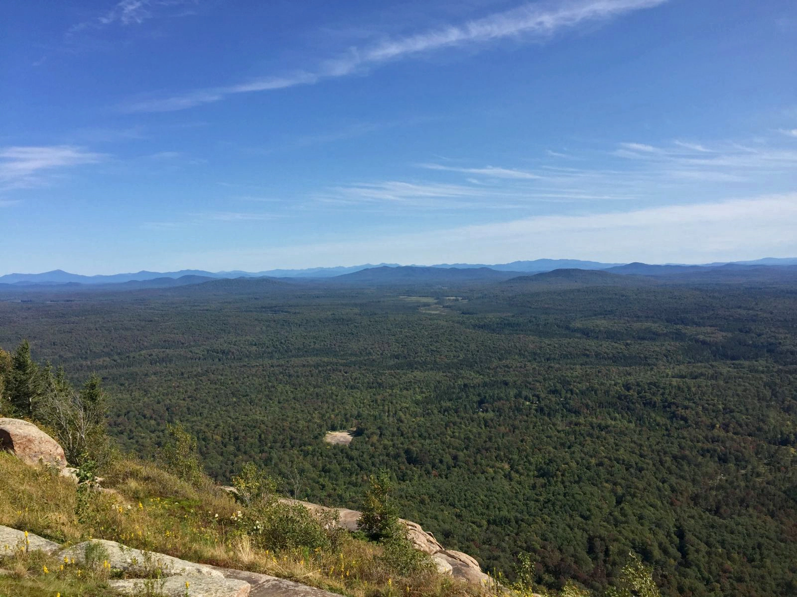
A short but steep climb up Azure Mountain and its firetower provides a sweeping view of the northern Adirondack Mountains and the St. Lawrence Valley. The Friends of Azure Mountain sometimes have a volunteer firetower steward on the summit to answer questions in summer months. The fire tower was built in 1918 and recently restored.
Key takeaways
Distance: 1.9 miles round trip
Elevation gain: 940 feet
Elevation: 2,518 feet
Hiking Azure Mountain
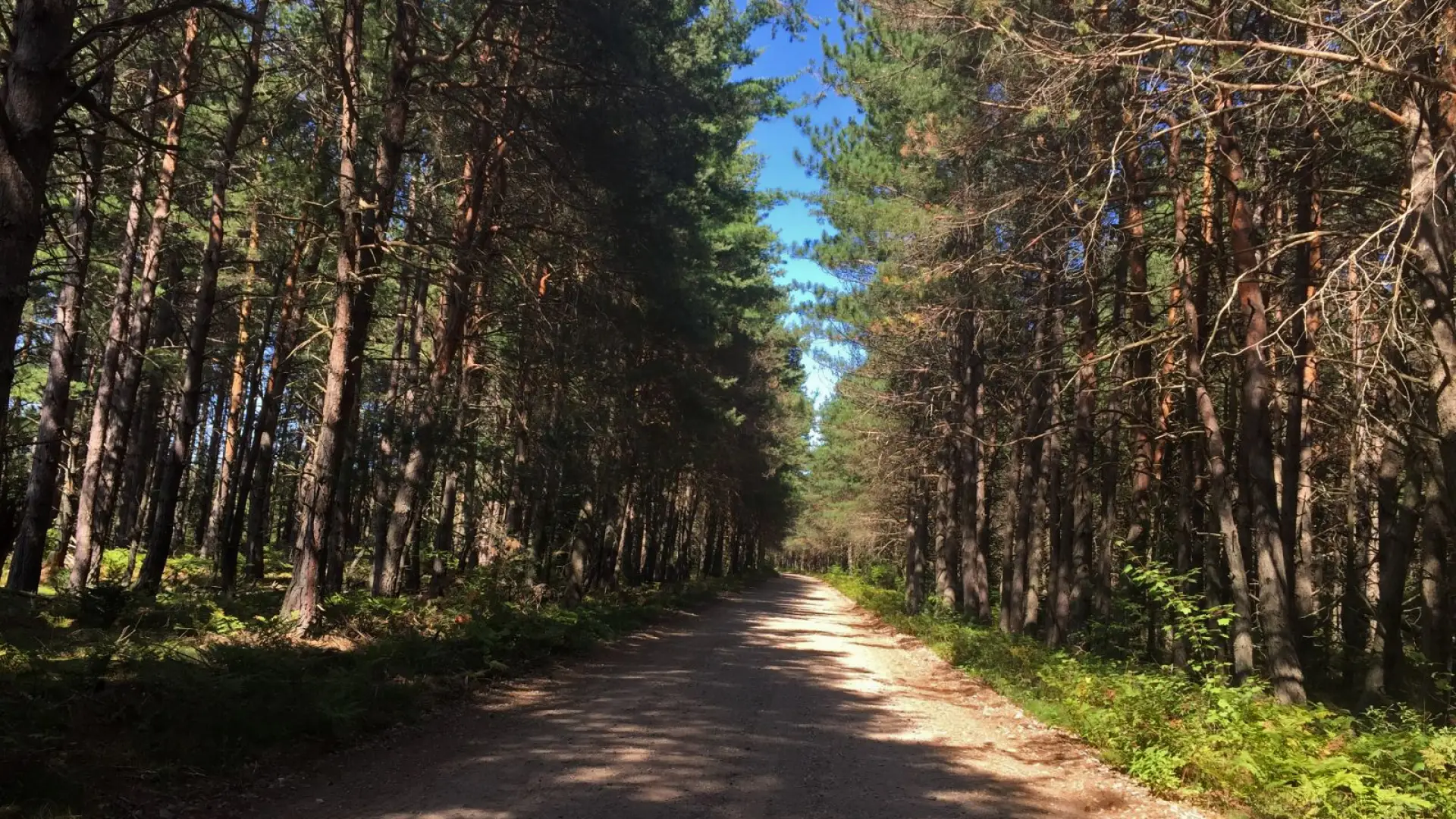
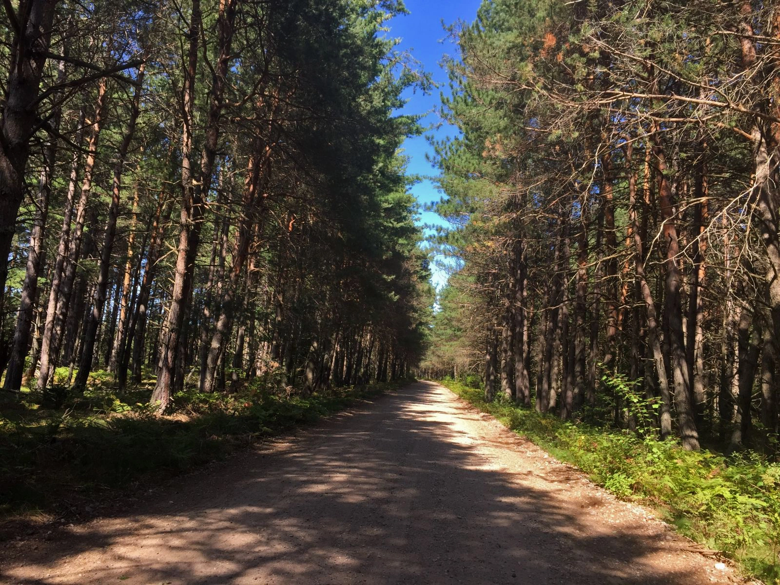
The route up Azure is about as straightforward as it gets. The beginning of the trail is deceptively easy as it passes through a nice, open forest. The path soon begins to ascend the base of the mountain, but it doesn't get steep until about halfway to the summit. Once the steepness starts it doesn't end until the top, where breathtaking views will reward you for your efforts.
Azure in the winter
This is a short but challenging snowshoe to a fantastic view. Snowshoes are necessary to avoid post-holing through the snowpack, and microspikes might be helpful to ascend the mountain's steeper sections. Extra layers of non-cotton clothing, a windbreaker, emergency blanket, first-aid kit, headlamp with extra batteries, and plenty of food and water are essential items for any winter excursion. The extra layers and windbreaker are especially important on the exposed summit ledges, which will be much colder than the lower sections of the mountain. Don't underestimate the short distance of this hike — start early and set aside plenty of time to complete this hike in the winter. Be prepared for winter conditions.
Explore more trails
Does Azure Mountain sound amazing, but a little more than you want to tackle right now? No need to stress, we can help you find an Adirondack trail that’s right for you!
How to get there
There are two ways to get to the Azure Mountain trailhead from Saranac Lake. The most direct route involves driving along Blue Mountain Road via Keese Mills Road. Even though it's more than 10 miles shorter, Blue Mountain Road is a narrow, windy, little-used dirt road that must be taken slowly. We recommend the route described below, which takes the same amount of time and sticks to paved main roads.
From Saranac Lake, follow Route 86 to Paul Smiths, about 11 miles. At the intersection with Route 30 in Paul Smiths, turn right on Route 30 and follow that for 9 miles, then turn left on Route 458. Follow 458 for 13 miles and turn left on Blue Mountain Road (this end is paved) and follow it for 7 miles, then turn right at the large brown and yellow DEC sign to get to the parking area.
