Loon Lake Mountain

   View trailhead on map
Round Trip
5.7 miles
9.2 kilometers

Elevation
The height of the summit or destination, from sea level.
3314 feet
1,010.1 meters

Elevation Gain
The total amount of vertical ascent (uphill climbing) on a hike. This is cumulative gain, totalling the elevation change of the uphill segments from a round-trip hike.
1690 feet
515.1 meters

Route Type
A hiking trail may be classified as a Loop, Out and Back, Point to Point, Bushwhack, or Multi-day Thru Hike, with some destinations having more than one of these ways as a hiking option.
  • Out and Back
Round Trip
5.7 miles
9.2 kilometers

Route Type
A hiking trail may be classified as a Loop, Out and Back, Point to Point, Bushwhack, or Multi-day Thru Hike, with some destinations having more than one of these ways as a hiking option
  • Out and Back
Elevation
The height of the summit or destination, from sea level.
3314 feet
1,010.1 meters

Elevation Gain
The total amount of vertical ascent (uphill climbing) on a hike. This is cumulative gain, totalling the elevation change of the uphill segments from a round-trip hike.
1690 feet
515.1 meters

Round Trip
5.7 miles
9.2 kilometers

Route Type
A hiking trail may be classified as a Loop, Out and Back, Point to Point, Bushwhack, or Multi-day Thru Hike, with some destinations having more than one of these ways as a hiking option
  • Out and Back
Elevation
The total amount of vertical ascent (uphill climbing) on a hike. This is cumulative gain, totalling the elevation change of the uphill segments from a round-trip hike.
3314 feet
1,010.1 meters

Elevation Gain
The total amount of vertical ascent (uphill climbing) on a hike. This is cumulative gain, totalling the elevation change of the uphill segments from a round-trip hike.
1690 feet
515.1 meters

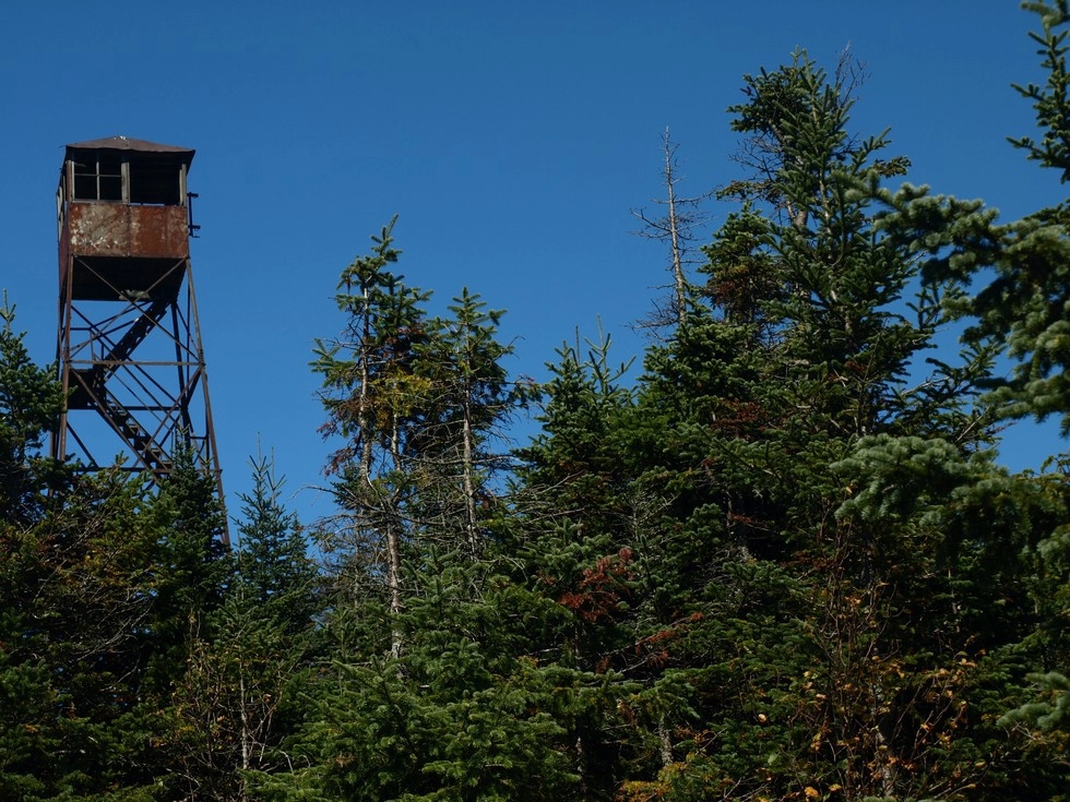
The old, rusty firetower on Loon Lake Mountain
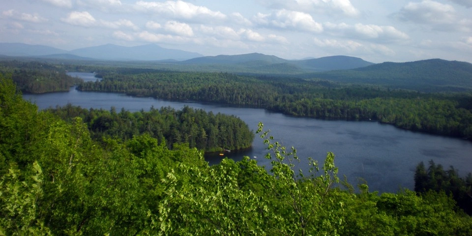
The views of Loon Lake from Loon Lake Mountain
View all photos
trail highlights
trail features
trail category
Fire Tower
Historical Sites
360° View
Trail Junctions
Mountain
Half Day

About

Loon Lake Mountain is a moderately difficult route that follows old woods roads and a steep trail to the summit, where there are great views from the ground and a 35-foot fire tower. Unfortunately, at this time, the tower cannot be climbed.

Key takeaways

  • Distance: 5.7 miles round trip
  • Elevation gain: 1,690 feet
  • Elevation: 3,314 feet
  • Hike includes trail junctions and bridges

Hiking Loon Lake Mountain

The trail starts out following an old woods for a little over 1.25 miles to where there's an arrow pointing to the foot path. From the turn, the trail begins to climb toward the summit. At 2 miles there is the first of several bridges — things also get progressively steeper from this point on. The final push to the top ascends a mossy, rocky stream that's steep and slippery. The views from the summit rock are outstanding, and hikers can explore around the summit for additional views of the area, including south to Whiteface Mountain.

Loon Lake Mountain in winter

Loon Lake Mountain is a difficult snowshoe, so be sure to leave early. Snowshoes are necessary to avoid postholing through the snowpack, and microspikes are suggested for ascending the mountain's steeper sections, although they might not be absolutely necessary. Extra layers of non-cotton clothing, a windbreaker, emergency blanket, first-aid kit, headlamp with extra batteries, and plenty of food and water are essential items for any winter excursion. The extra layers and windbreaker are especially important on the summit, which is exposed and likely to be much colder than the lower sections of the mountain. Be prepared for winter conditions.

Explore more trails

Does Loon Lake Mountain sound amazing, but a little more than you want to tackle right now? No need to stress, we can help you find a uniquely Adirondack trail that’s right for you!

How to get there

From Saranac Lake take Route 3 east and turn left on County Route 26 after about 15.5 miles. The parking area is on the left after about 8 miles. Take care on this road as it may just be hard-packed snow.

Emergency Information
If you get lost or injured, remain calm and stay put. If you have cell service, call 911 or the DEC Forest Ranger Dispatch, 833-NYS-RANGERS (833-697-7264).
 
Plan ahead and hike smart. Bring a map, extra food, water, and warm clothing, and check the weather before you go. Stay aware of your surroundings and landmarks. If you get turned around, don’t panic—stop, think, and stay where you are. Let someone know your route and expected return time.
×