
Panther Mountain

   View trailhead on map
Round Trip
0.9 miles
1.4 kilometers

Elevation
The height of the summit or destination, from sea level.
2236 feet
681.5 meters

Elevation Gain
The total amount of vertical ascent (uphill climbing) on a hike. This is cumulative gain, totalling the elevation change of the uphill segments from a round-trip hike.
475 feet
144.8 meters

Route Type
A hiking trail may be classified as a Loop, Out and Back, Point to Point, Bushwhack, or Multi-day Thru Hike, with some destinations having more than one of these ways as a hiking option.
  • Out and Back
Round Trip
0.9 miles
1.4 kilometers

Route Type
A hiking trail may be classified as a Loop, Out and Back, Point to Point, Bushwhack, or Multi-day Thru Hike, with some destinations having more than one of these ways as a hiking option
  • Out and Back
Elevation
The height of the summit or destination, from sea level.
2236 feet
681.5 meters

Elevation Gain
The total amount of vertical ascent (uphill climbing) on a hike. This is cumulative gain, totalling the elevation change of the uphill segments from a round-trip hike.
475 feet
144.8 meters

Round Trip
0.9 miles
1.4 kilometers

Route Type
A hiking trail may be classified as a Loop, Out and Back, Point to Point, Bushwhack, or Multi-day Thru Hike, with some destinations having more than one of these ways as a hiking option
  • Out and Back
Elevation
The total amount of vertical ascent (uphill climbing) on a hike. This is cumulative gain, totalling the elevation change of the uphill segments from a round-trip hike.
2236 feet
681.5 meters

Elevation Gain
The total amount of vertical ascent (uphill climbing) on a hike. This is cumulative gain, totalling the elevation change of the uphill segments from a round-trip hike.
475 feet
144.8 meters

View from summit of Panther Mountain with Route 3 (Tupper-Saranac Highway)
View all photos
trail highlights
trail features
trail category
Short

About

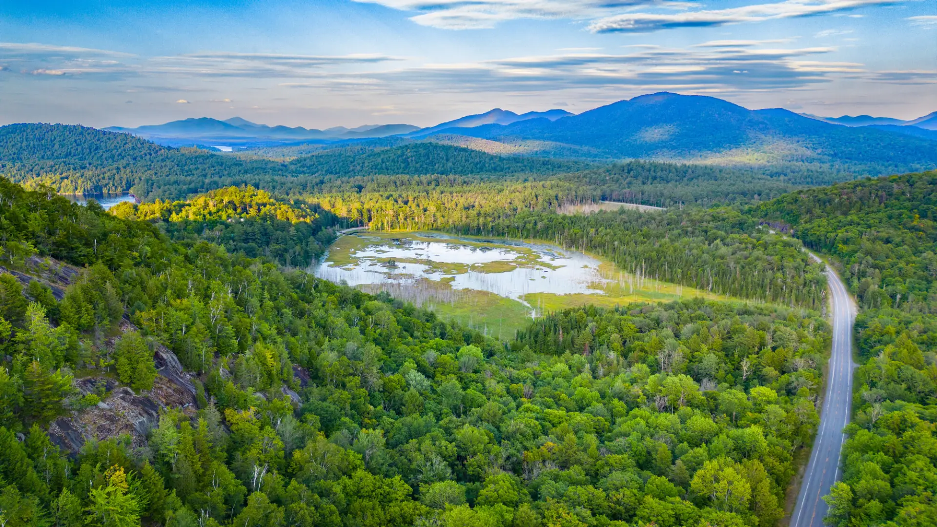
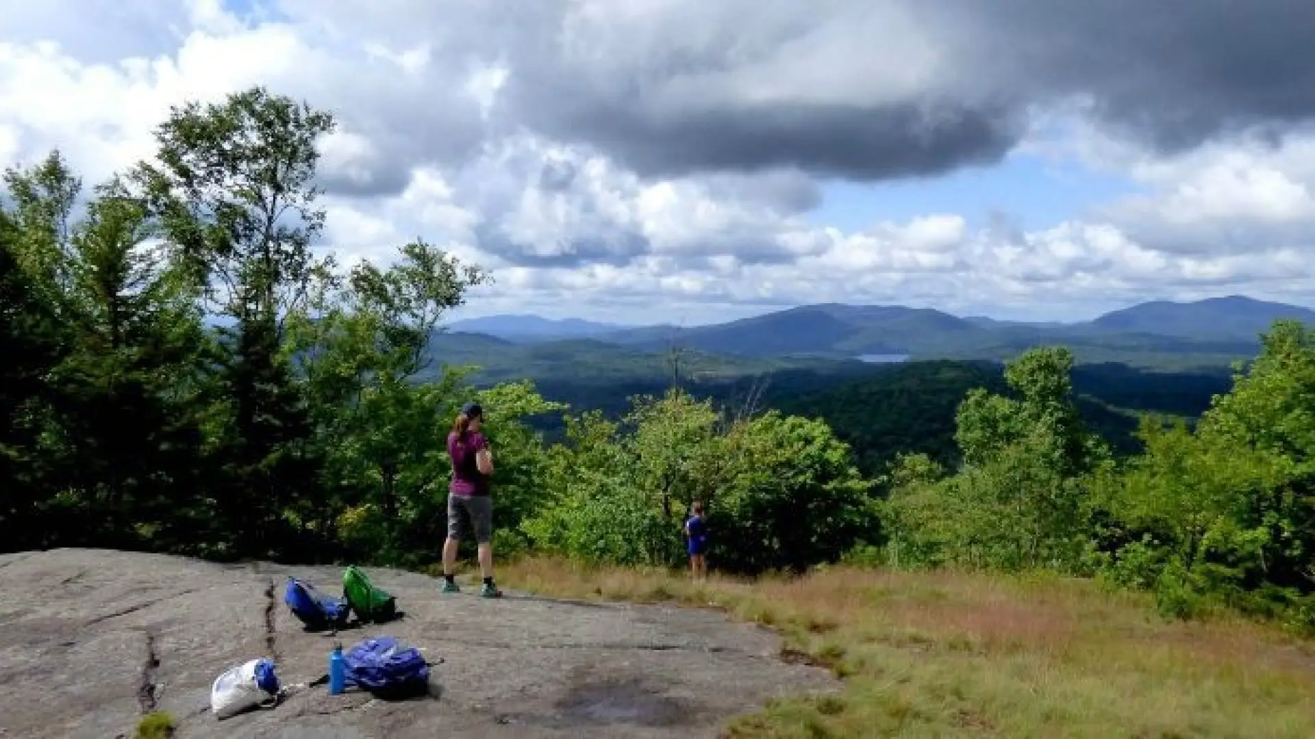
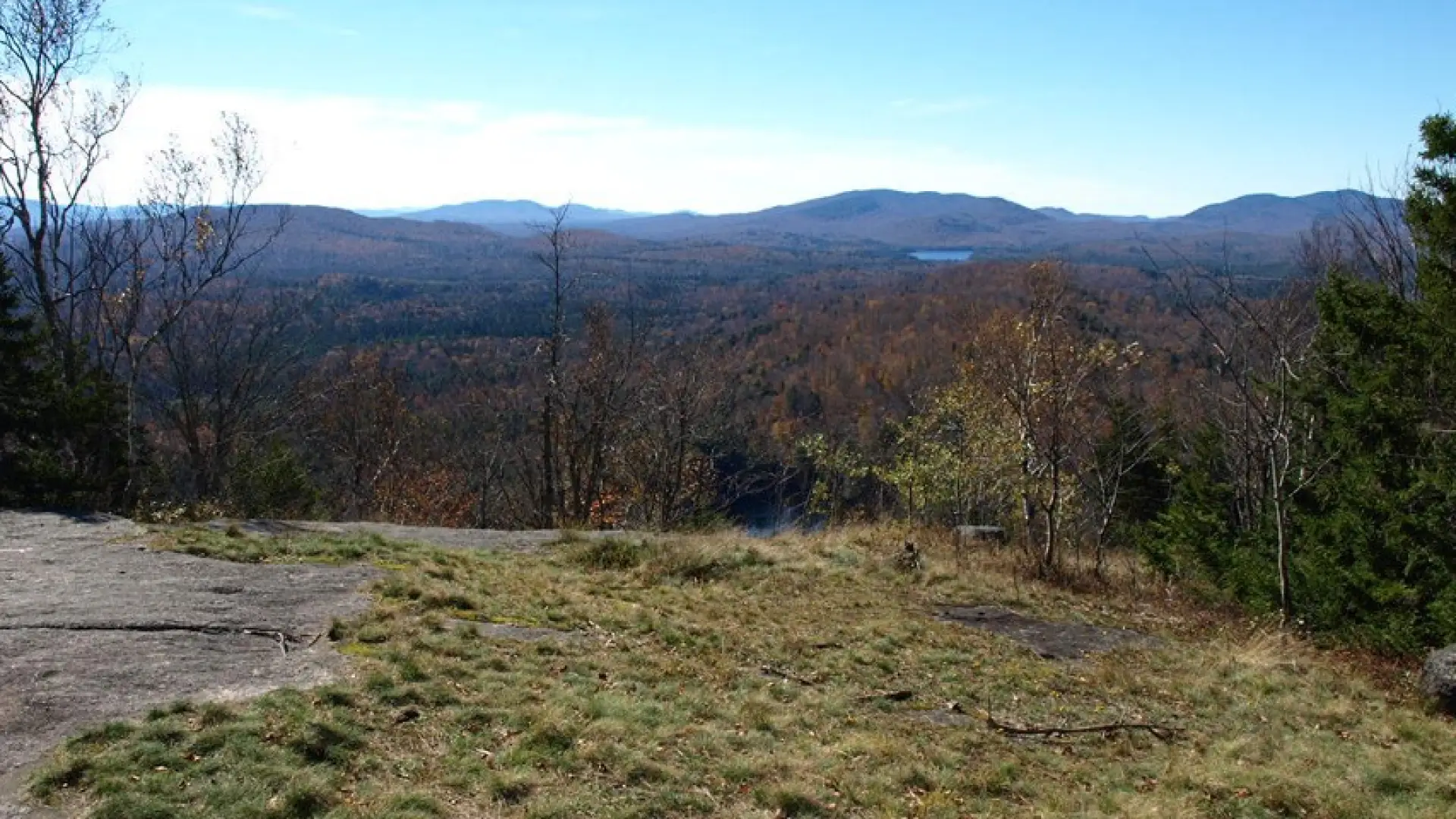
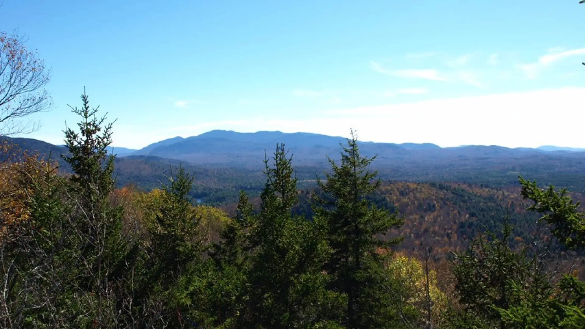
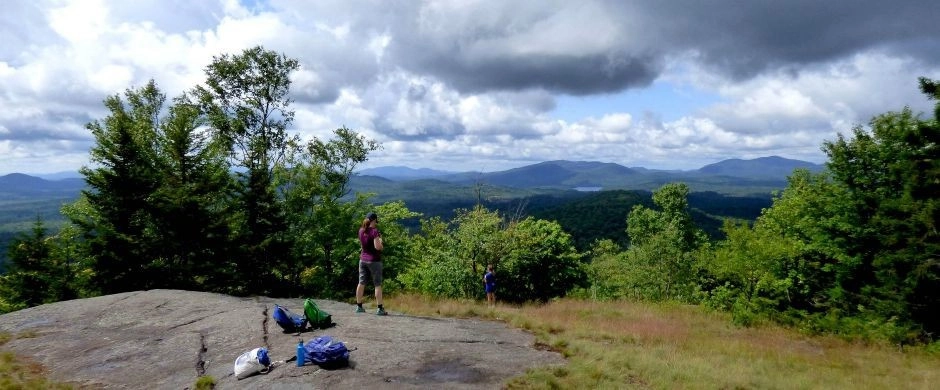
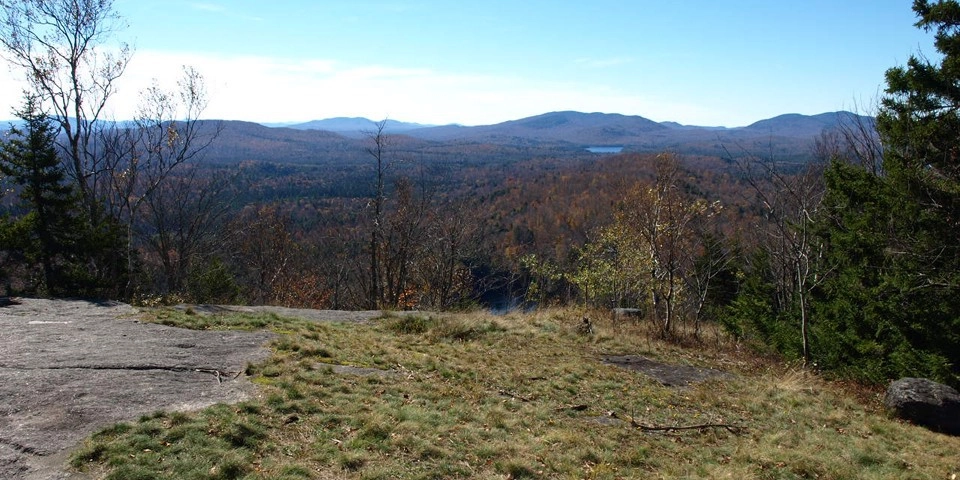
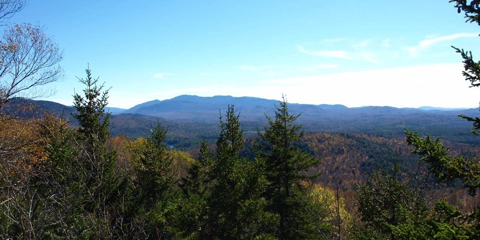
Panther Mountain is a short, but steep, "bang for your buck" hike leading to fabulous views of distant mountains and Panther Pond below.

Key takeaways

  • Distance: 0.9 miles round trip
  • Elevation gain: 475 feet
  • Mountain elevation: 2,236 feet

Hiking Panther Mountain

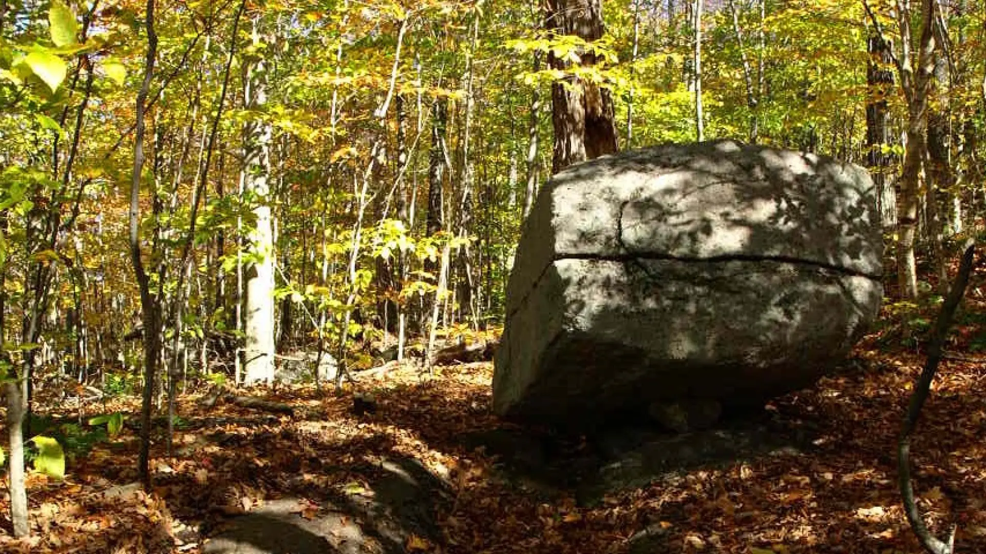
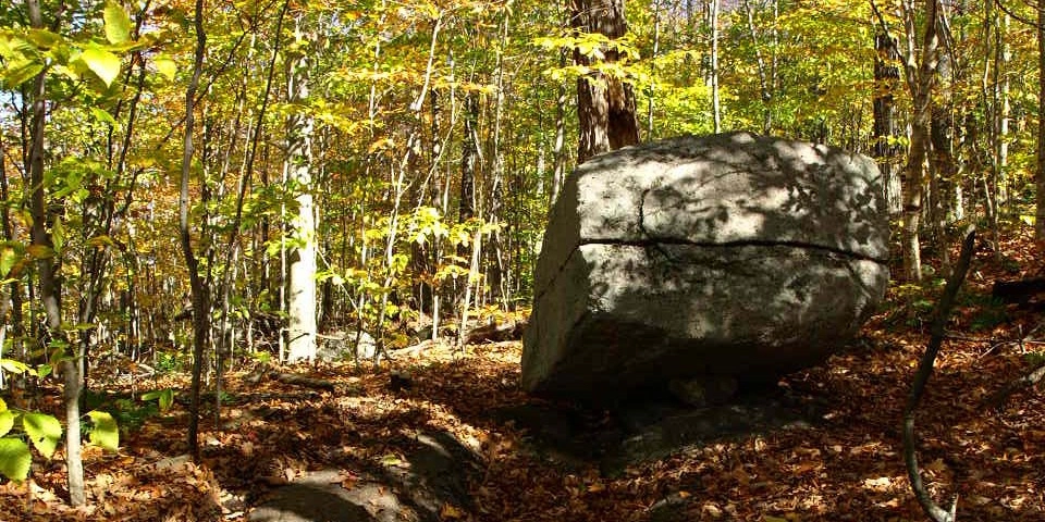
Crossing the road from the parking lot, the trail starts climbing right away with tall pines towering over you. The trail then swings west to reduce the grade a bit and then back to the east to gain a small ridge that brings you to the partially open summit. From the summit area the Seward Range can be seen to the south, and Panther Pond below.

Panther in the winter

In the winter, the parking area is typically open, and many people do snowshoe up. Being a bit steeper, it is also a good idea to be prepared and bring microspikes.

Discover more trails

Does Panther Mountain sound amazing, but a little more than you want to tackle right now? No need to stress, with endless mountains, lakes, and waterfalls to visit in the Adirondacks, we are sure we can help you discover a trail that’s just right!

How to get there

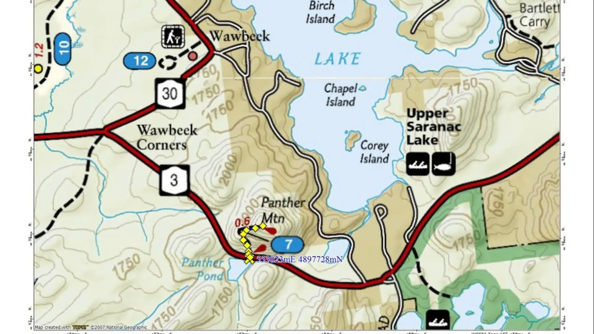
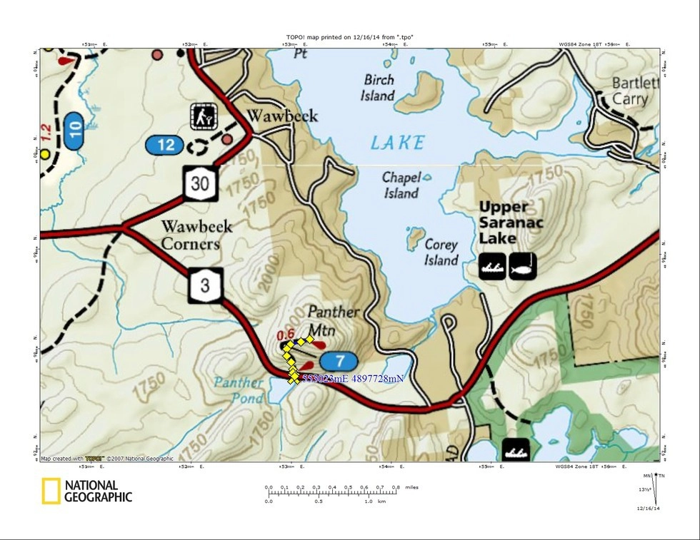
From the intersection of Route 3 and Route 86 in Saranac Lake, take state Route 3 toward Tupper Lake for 13.1 miles. There is a small parking area on the left, and the trail starts about 100 yards further on the opposite side of the road.

Emergency Information
If you get lost or injured, remain calm and stay put. If you have cell service, call 911 or the DEC Forest Ranger Dispatch, 833-NYS-RANGERS (833-697-7264).
 
Plan ahead and hike smart. Bring a map, extra food, water, and warm clothing, and check the weather before you go. Stay aware of your surroundings and landmarks. If you get turned around, don’t panic—stop, think, and stay where you are. Let someone know your route and expected return time.
×